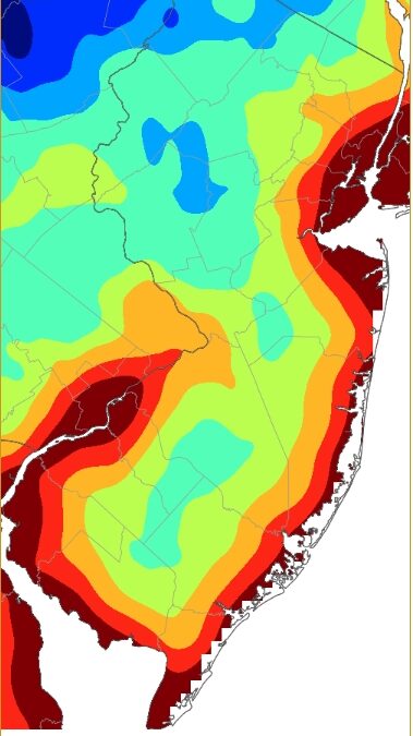
A series of hard freezes hit farms and bogs hard in New Jersey and beyond during late April, causing an estimated $300 million in crop losses, with crop damage exceeding 30% in many parts of the state.
On May 20, Gov. Mikie Sherrill declared a state of emergency for all 21 counties in the state. She also sent a letter to U.S. Secretary of Agriculture Brooke Rollins to unlock federal funding relief for New Jersey farms.
“This freeze was unlike anything our growers have experienced in decades, and the damage is staggering,” said Sen. Cory Booker. “An entire season of peaches, apples and grapes were almost entirely decimated in a matter of hours. Many other fruits are also suffering significant losses. New Jersey farmers urgently need federal support to recover from this disaster.”
Maybe you know of a farmer who had losses. After all, there were over 600 farms between Cape May and Atlantic counties in 2022, according to the U.S. Department of Agriculture. That’s over 38,000 acres responsible for $167 million in products sold. Tourism, agriculture and fishing are the top three economic engines at the South Jersey shore. All are dependent on weather.
Freezes in late April are common for inland New Jersey. The average last freeze of spring at Hammonton is April 18, according to the National Oceanic and Atmospheric Administration. Atlantic City International Airport’s is April 19. In the deeper Pinelands, the last freeze on average is near the end of the month.
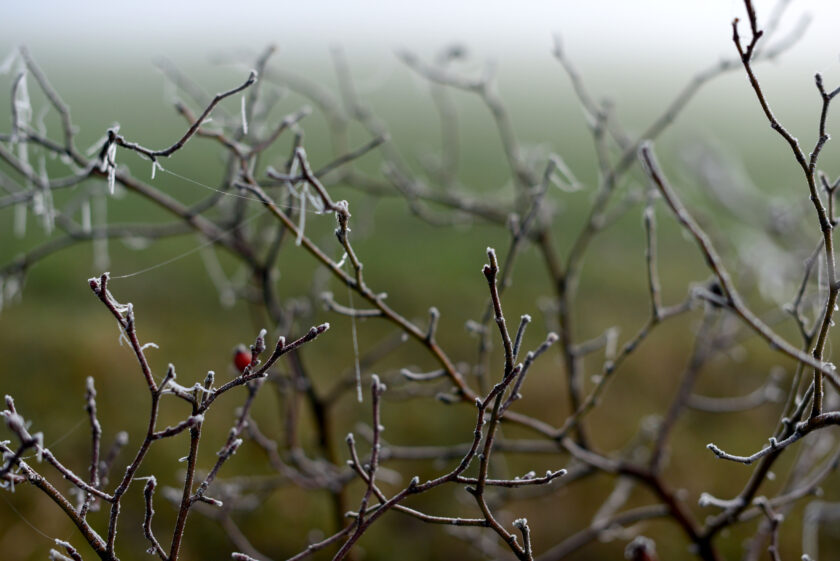
But what happened on April 21 was not normal for two reasons and may be more of a sign of things to come. First is just the sheer cold of that morning. Not only were inland low temperatures for the coastal counties below freezing, but they were at or below 28 degrees in spots. That’s considered a hard freeze which destroys most seasonal vegetation, especially the young, tender crops that were just starting to grow.
- Berkeley: 21 degrees
- Vineland: 24 degrees
- Woodbine: 25 degrees
- Estell Manor: 27 degrees
- Dennis: 27 degrees
- A.C. Airport: 28 degrees
“Suffice it to say that this is one of the most widespread disasters on record to strike almost every fruit-growing tree, bush, or vine in the state. The horticultural industry also appears to have taken a notable hit,” said Dave Robinson, the New Jersey state climatologist, in his monthly report for April.
It wasn’t just the cold temperatures that made the agricultural loss devastating, prompting the state of emergency. It was the weather that led up to it.
It was warm. Really, it was hot. Temperatures sizzled between 85 and 95 degrees between April 14 and April 17, according to NOAA. Overnight lows stayed in the 50s and 60s.
That kind of warmth drove crops and plants to open and grow faster than usual for that time of the year.
When the freeze came on April 21, the plants were left exposed and many were killed. This will surely be a top 10 weather event for the year.
The executive order issued by Gov. Sherrill provides for increased coordination between state agencies to help farmers with what they may need. State Police Superintendent Jeanne Hengemuhle will lead the effort.
Federal crop insurance which, like the National Flood Insurance Program many of us are aware of at the shore, is backed by the Federal Government to protect against losses that many private insurers won’t take on. The problem is it has a cap of $325,000. For large farms, that’s just a percentage of what they could have lost.
While frosts and freezes during the growing season are fairly common, most are minor issues for farmers. The last significant one was in 2012. That year, a hard freeze hit on April 28, about a dozen days after a stretch of warm weather with lows in the 50s and highs in the 80s.
This year’s killing freeze arrived much sooner after the warm weather ended than it did in 2012 – and it was also a bit colder.
In our climate-changing world, sharp, hard freezes after days of plant-growing heat are expected.
The date of the last freeze of the year hasn’t changed much over the decades. In fact, at Atlantic City International Airport, the average last freeze is three days later now (April 18) than the average was in the 1970s (April 15-16). In Hammonton, it’s been roughly the same – around April 15.
However, hot days are occurring earlier. Three days or longer of high temperatures of at least 80 degrees in April has about a 20% chance of occurrence in the 2020s. In the 1970s, it was about 5%. The result is more growth in our fruits, vegetables and crops before a killing freeze.
The last freeze is barely changing because the ingredients for a cold spring night aren’t as influenced by a changing climate. It requires a clear sky, light wind and low dew points.
Meanwhile, warmer spring days are driven by the greenhouse effect. The more greenhouse gases in the air, the more solar radiation from the sun is trapped near the surface, where we live.
Finally, not to rub salt in the wound with this article, but I gave Memorial Day Weekend a “D” in the Shore Summer Weekend Weather Report Card. The first weekend of our eighth edition earned the barely passing grade, mainly because of Monday. Temperatures finally got out of the 50s at the beach and it wasn’t an all-day washout. Better luck this weekend.
Joe Martucci, a Certified Broadcast Meteorologist and Digital Meteorologist, is the President and Director of Meteorology for Cup A Joe Weather and Drone. You can connect with him at cupajoe.live.