We live by the sea breeze and die by the sea breeze.
Figurately, of course, but only kind of. How often has it been 95 degrees in Hammonton or Trenton, only to fall to 78 degrees in Ocean City or Atlantic City? That kind of change would make you feel alive if you made that trek to the beach.
Alternatively, take May 4. It was 72 in Hammonton and Trenton. Atlantic City was 58 degrees. I have a feeling that took the life out of some outdoor plans.
Even if you’re at the beach all day, how many times has it felt hot in the late morning? Then, you cool off with a refreshing breeze for the afternoon.
Sea-breezes are a near daily occurrence of our lives for the Jersey Shore from roughly March to August. May is typically home to the strongest sea breezes and strongest differences between inland and coastal areas.
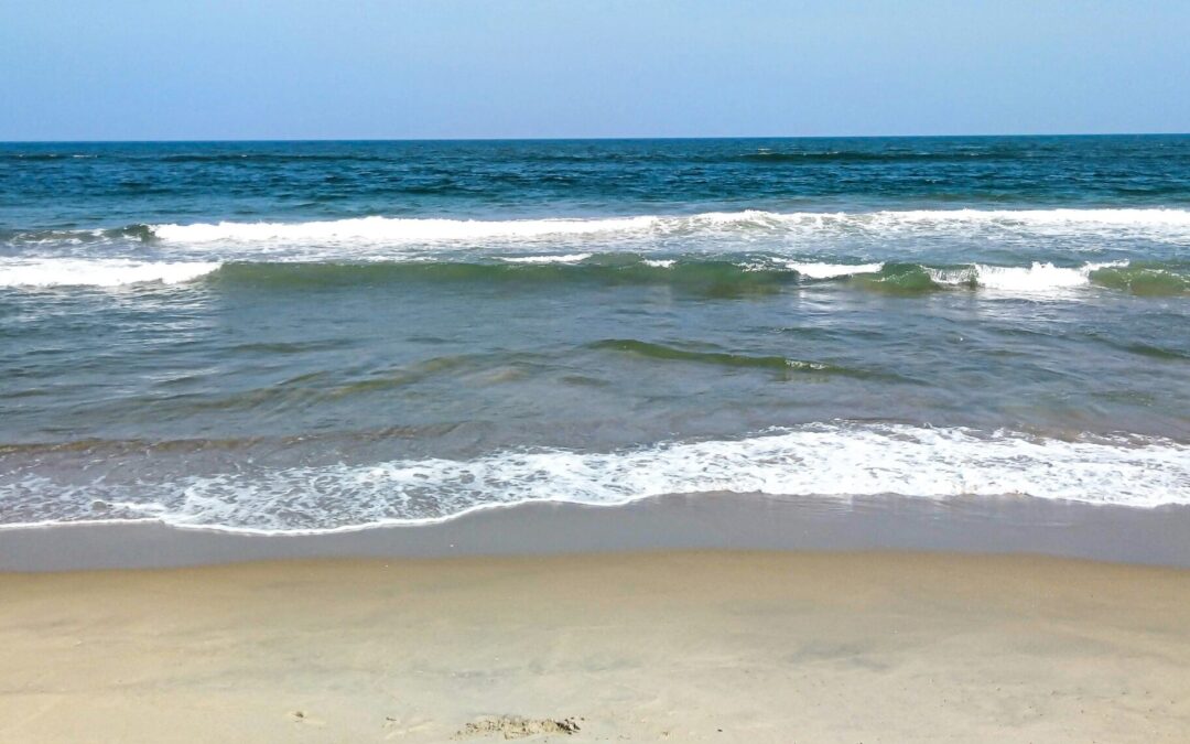
The sea breeze makes the Jersey Shore the $20 billion economic engine it is according to the New Jersey Department of Tourism (2023). Doctors would prescribe patients time at the water’s edge to take in the cleaner air coming in from the ocean. Before air conditioning, the Camden and Atlantic Railroad, the West Jersey Railroad, Tuckerton Railroad and more opened the dream of refreshing summer air to the masses. Even today, the thought of a beach chair on the sand with the warm sun and cool breeze in your face is a pleasant sight.
Why do sea breezes happen?
In short, the sea-breeze is Planet Earth’s way to bring equilibrium to the atmosphere. The Earth is always trying to stay balanced against the constant change in the Earth’s tilt, orbit around the sun and more.
In more detail, the sea breeze is caused by the sun warming up the land much faster than the body of water. It takes roughly 4.2 times more energy to heat up water a degree versus heating up land. Mainly, it’s because water, a liquid, can mix around, shifting its temperature around, faster than a patch of beach or forest can. The scientific phrase for this is heat capacity.
Warmer air also brings lower air pressure. Cooler air brings higher air pressure. Winds always move from high pressure to low pressure. Due to physics, cooler air up to about 3,000 feet high will actually move onto land. That warmer air rises into the atmosphere. The line between the land breeze and sea breeze can create clouds. If there’s a lot of upward motion, it’ll even create rain showers.
Sea breezes are localized features we call mesoscale features. It’s different than the widescale, synoptic winds that blow. If winds are blowing out of the northeast, off the water, due to a nor’easter, that is not a sea breeze. That’s just the way the wind’s blowing.
Sea breezes typically blow at 10 to 20 mph.
Mini cold fronts
The cooling sea breezes we see in New Jersey are actually mini cold fronts moving in from the east. Typically, most cold fronts we think of in New Jersey come from the west or north. The drier, typically cooler air that follows the cold front are west or north winds. That is blowing in air from the larger area of high pressure in, say, Canada, replacing the lower pressure air.
In New Jersey, the sea breeze cold fronts are stronger than other areas of the United States. That’s because of the Pine Barrens. The sandy soil of the Pinelands means the land heats up faster than other landmasses. It’s common for Egg Harbor City or Batsto to be the hottest place in the state. That creates a bigger air pressure gradient, which creates a stronger sea breeze.

How to spot a sea breeze in NJ
Keep in mind that northeast, east or southeast winds that blow for days at a time are not the sea breezes we’re talking about here.
To have a real sea breeze, winds need to start out from an offshore direction and then shift onshore as the day goes on.
First, you’ll need the sun to heat the ground for a few hours. A cloudy sky can bring a sea breeze during the late spring and summer, too, thanks to how strong the sun is.
The strength of the wind matters, too.
If winds are constantly blowing under about 15 mph, there’s a good chance the sea breeze will form during the late morning or midday if the large-scale winds are from offshore at first.
As an example, if 10 mph from the southwest start off the morning, you’ll get a sea breeze to develop by noon.
If winds are over about 15 mph, whether you see a sea breeze depends on the direction that large-scale wind is blowing.
Winds from the west or northwest will be too strong for the sea breeze to develop. They directly push back against it. These are the days that are the hottest on sand and inland. In fact, seven of the top 10 hottest days at Sen. Frank S. Farley State Marina in Atlantic City had a wind out of the westerly or northwesterly direction, according to Open-Meteo and ERA5 data.
Sadly, it’s also the days when the bugs swarm the shore all day long.
However, winds from the southwest or north at those higher speeds don’t directly push against the developing sea breeze. Typically, they’ll still form.
The Delaware Bayshore also gets cooling sea breezes, but they’re not as noticeable since the bay temperature is more in line with the land temperatures nearby. There isn’t as much as an air pressure gradient that creates that cooling wind.
Still, for Cumberland and Salem counties, any wind that isn’t pushing directly against the coastline or with it can cause a sea breeze.
For Cape May County’s Bayshore, a south or north wind can still develop those localized sea breezes.
Joe Martucci, a Certified Broadcast Meteorologist and Digital Meteorologist, is the President and Director of Meteorology for Cup A Joe Weather and Drone. You can connect with him at cupajoe.live


.