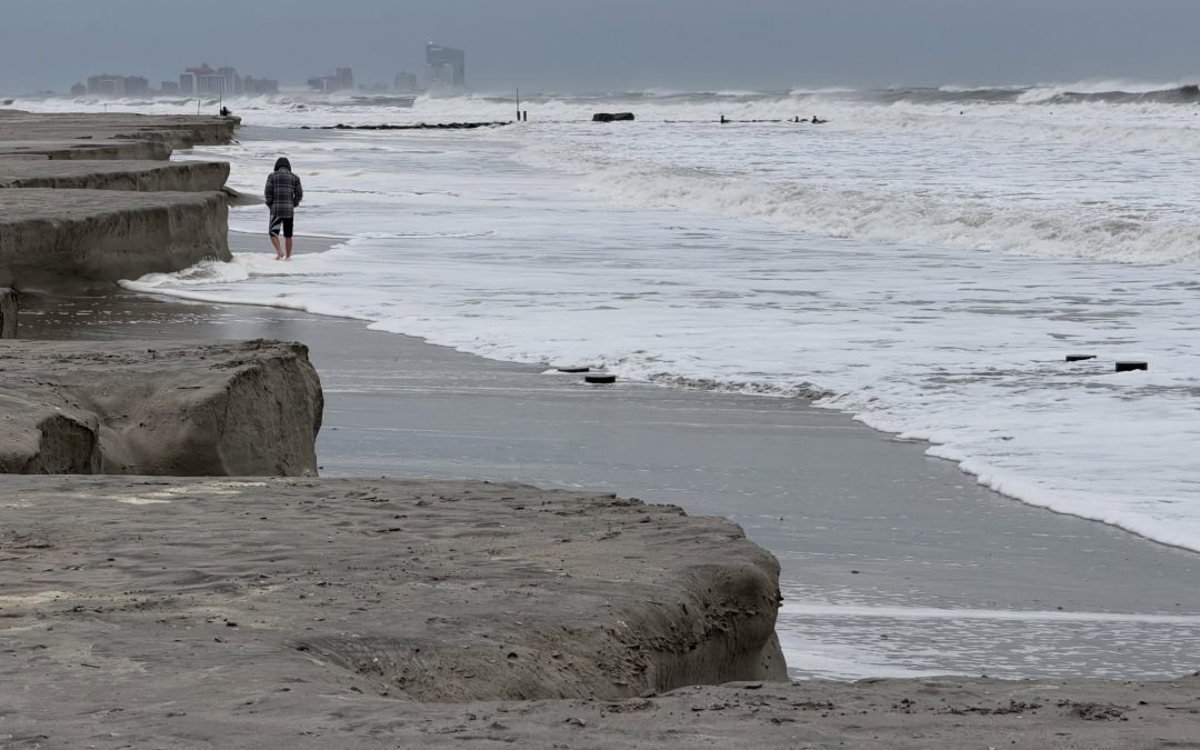
A powerful September nor’easter left a trail of flooding, stranded vehicles, battered beaches and emergency rescues across the Jersey Shore over the weekend, with some communities receiving more than 4 inches of rain and experiencing tidal flooding comparable to major past storms.
The slow-moving coastal system intensified more than initially expected as it approached New Jersey, bringing several rounds of heavy rain, strong winds and pounding surf from Friday through Sunday.
By Monday, communities from Atlantic City to Cape May were beginning the cleanup while assessing damage to roads, homes, businesses and beaches.
Major flooding on barrier islands
Saturday brought some of the storm’s worst conditions.
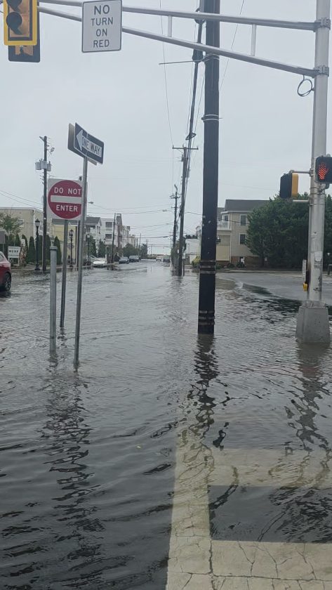
Ocean City experienced major flooding that left many streets impassable. For a time, all bridges onto the island were closed. The Ocean City-Longport Bridge and 34th Street Bridge later reopened, while the Ninth Street Bridge remained closed Saturday as water surrounded portions of the causeway.
The Saturday morning high tide reached 7.63 feet on the mean lower low water scale in Ocean City, nearly matching the 7.66-foot level recorded during the January 2016 nor’easter known as Jonas.
Sea Isle City declared a local state of emergency and ordered residents and visitors to stay off the roads. Police reported extreme flooding and numerous calls involving vehicles that had become stranded after motorists attempted to cross flooded streets.
Atlantic City saw similar conditions. Floodwaters covered portions of the city and Route 40, and firefighters responded to roughly 20 reports of vehicles stuck in floodwater Saturday. Many of those vehicles had to be towed.
Videos of kayakers paddling up main streets went viral across social platforms.
Nine adults and a dog rescued from West Atlantic City motels
One of the weekend’s most serious local incidents unfolded along the Black Horse Pike in West Atlantic City.
Firefighters rescued nine adults and a dog from the Travel Inn and New Sea Breeze motels after tidal water reached approximately 2 to 3 feet deep inside first-floor rooms. One of the people rescued used a wheelchair.
Pleasantville firefighters initially responded to check on motel guests before Bargaintown firefighters arrived with a high-water rescue vehicle and equipment.
The evacuees were taken to a warming center at the Egg Harbor Township Community Center, where local EMS, police, public works and recreation personnel assisted them.
When firefighters returned to inspect the motel rooms, they discovered a small fire inside a room at the Travel Inn. It was extinguished without injuries. Officials later helped relocate the displaced guests to second-floor motel rooms.
Beaches take a beating
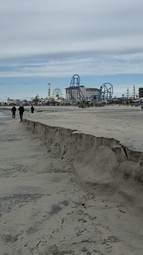
Powerful surf significantly reshaped portions of the South Jersey coastline, particularly in Atlantic City. Atlantic City Beach Patrol officials said the erosion was the worst the city has seen since Hurricane Sandy in 2012.
A roughly half-mile stretch north of Steel Pier was particularly hard hit. Waves carved into protective dunes, exposed structures that had previously been buried under sand and created steep drop-offs along the shoreline.
Atlantic City Beach Patrol Deputy Chief Dave Russo estimated that about half of the dunes remained in parts of the affected area. City crews are expected to address some of the steep sand cliffs left behind to make beach access safer.
The erosion also affected Ocean City, where the storm arrived only weeks after completion of a major federal beach replenishment project. Large waves stripped away significant amounts of sand and left steep scarps along parts of the shoreline.
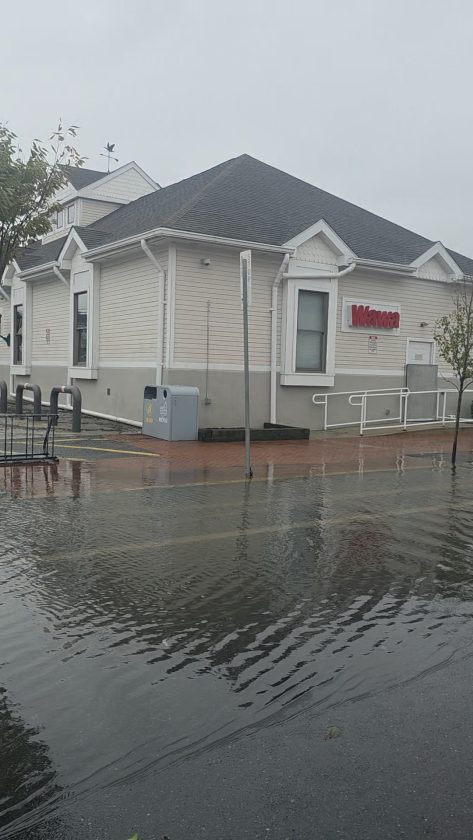
Elsewhere along the coast, waves and storm surge pushed water well beyond normal tidal boundaries, inundating streets and low-lying properties throughout barrier-island communities.
Rainfall totals top four inches
The nor’easter also delivered substantial rainfall, including more than 4 inches in portions of Atlantic and Cape May counties.
Town-by-town totals included approximately:
– Hammonton: 4.75 inches
– Linwood area: 3.57 inches
– Egg Harbor Township: 3.49 inches
– Mays Landing: 3.46 inches
-Atlantic City: 2.89 inches
-Ocean City: 2.77 inches
The rain added to flooding caused by high tides and onshore winds, creating particularly difficult drainage conditions in low-lying coastal areas.
Strong winds and power outages
Wind gusts also reached damaging levels across the region.
Gusts reached 61 mph near Avalon and Wildwood, 57 mph in Atlantic City and 54 mph at Cape May Harbor. Farther north, Point Pleasant recorded a 74 mph gust — equivalent to hurricane-force wind speeds — while Harvey Cedars reached 69 mph and Long Beach Island reached 67 mph.
Across New Jersey, New York, Connecticut and Massachusetts, about 21,000 homes and businesses were still without power early Monday as the sprawling storm slowly weakened.
Cleanup begins
By Sunday and Monday, floodwaters had begun retreating in many South Jersey communities, allowing residents and municipal crews to begin assessing the damage.
Ocean City Mayor Jay Gillian said Sunday that city crews were beginning cleanup efforts and evaluating damage around the island. Some power restoration work had been delayed until floodwaters receded enough for utility crews to safely reach affected neighborhoods.
Atlantic City also faces a significant cleanup along its beaches, where the weekend storm erased large amounts of sand and reshaped sections of the shoreline.
Although September nor’easters are uncommon, this one provided a reminder of how quickly a coastal storm can combine wind, rainfall, tides and surf into a major event for barrier-island communities.
Cautiously optimistic
The nor’easter also comes as the Jersey Shore remains well within the Atlantic hurricane season, which officially runs through Nov. 30.
While NOAA’s updated 2026 outlook favors a below-normal season overall, the agency still projects 7 to 13 named storms, including two to six hurricanes and as many as two major hurricanes.
September and October are also historically among the most active months for tropical systems, with most Atlantic activity occurring between mid-August and mid-October.
NOAA cautions that seasonal outlooks cannot predict whether any particular community will be struck, meaning coastal residents should remain prepared for additional tropical systems, nor’easters and other coastal storms capable of producing flooding, damaging winds and beach erosion through the fall.
For many Shore residents, the weekend brought familiar scenes — flooded intersections, submerged cars and beaches carved away by the Atlantic — but the magnitude of the flooding and erosion made this storm one that South Jersey communities will be cleaning up from long after the skies clear.