By Meteorologist Joe Martucci
Last winter we received anywhere from 5.4 inches of snow in Ocean City to 8.7 inches of snow in Somers Point in our part of the Jersey Shore. That’s a far cry from average, but could very well be in line with what happens this winter coming up.
It’s time for the 2024-2025 Jersey Shore Winter Outlook, the annual tradition predicting probably our most controversial weather phenomenon: snow.
I was a guest speaker at the Cape May Museums, Arts, Culture (MAC) Lunch and Learn on Nov. 13. Roughly 30% of the audience said they wanted no snow in their lives, ever. Another 50% were one and doners – people who enjoyed one snow, but nothing more. About 10% of the group were like me – the more snow the better. I imagine you’re split about the same.
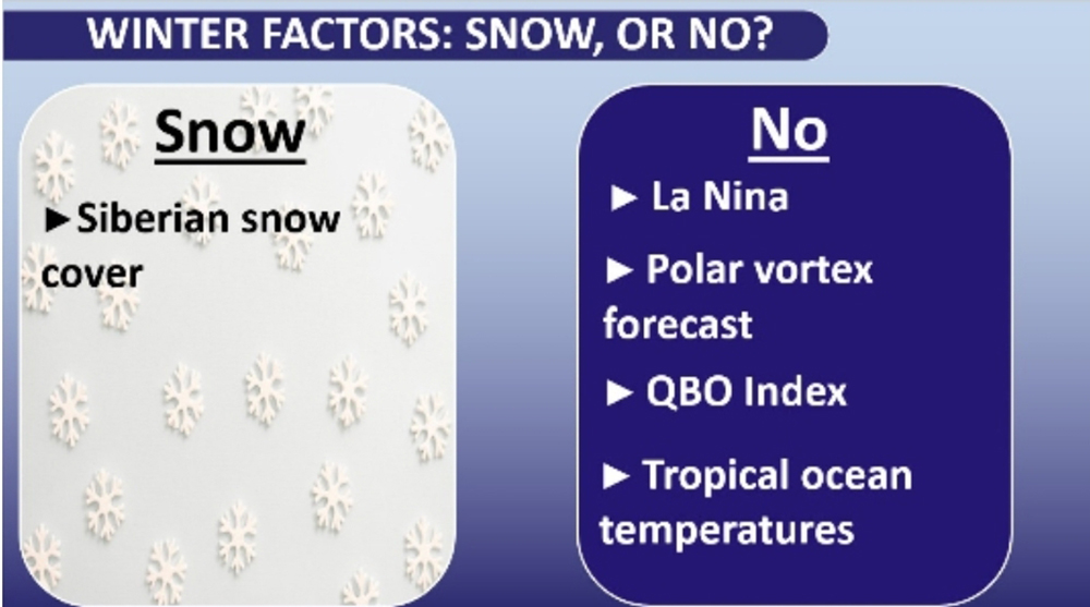
This winter, the development of a weak La Niña and positive Quasi Biennial Index (we’ll get into that later) are the main factors for a winter outlook that offers little in the way of predicted snowstorms.
I do not do my own winter forecasting. It takes months of research to complete one, with more skills than just a computer model. Rather, this comes largely based upon my conversations with Steve DiMartino, owner of NY NJ PA Weather; as well as Judah Cohen, director of seasonal forecasting at Atmospheric and Environmental Research.

Both spend considerable time pouring over data and forecasts to complete a thorough winter outlook. In the case of Cohen, he developed a theory for winter forecasting in the Northeast: The more snow in Siberia during October, the better likelihood for snow and cold here. That’s because the polar vortex – the cold dome of low pressure that rests at the North Pole during the winter – has a better chance of stretching or splitting, making its way down to our parts.
That’s pretty much the only factor that suggests this winter will be colder and snowier than the average one here at the Jersey Shore. Snowfall predictions by the Rutgers University Global Snow Lab show it slightly above average here. Otherwise, all other factors point toward a mild and less snowy winter.
Weak La Niña: A weak La Niña will develop over the winter, according to the National Oceanic and Atmospheric Administration. Historically, that has led to below-average snowfall in New Jersey. The farther south in the state you go, the more below average it is.
A La Niña occurs when water temperatures in the eastern tropical Pacific Ocean, off the coast of Peru, are cooler than average.
Positive Quasi Biennial Oscillation (QBO): The QBO is a pattern of changing winds high above the Equator, between 60,000 and 100,000 feet in the air. When it’s negative, the winds blow from east to west. When it’s positive, like this winter, the winds blow from west to east.
The QBO switches direction every 14 months. It’s one of the most regular weather patterns, second only to the changing seasons. A positive QBO means a drier winter, more often than not.
Warmer tropical Atlantic Ocean waters: Forecasts are for the tropical Atlantic Ocean to be warmer than the long-term average. Also known as a Warm Atlantic Quadpole Mode (AQM), this typically leads to drier-than-average conditions in South Jersey. In a true North-South Jersey divide, though, the northern half of the state typically sees more precipitation than usual.
Colder ocean waters near N.J.: Forecasts are also calling for water temperatures to be below average off the coast of the Northeast United States. To me, that means coastal storms won’t be as powerful. Storms like the big contrast between the cold landmass and the relatively milder water to explode and become powerful. Colder water means we won’t see that contrast.

Winter forecast summary
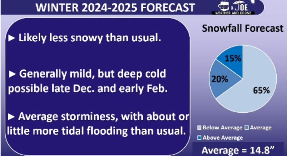
I give the Jersey Shore a 65% chance of snowfall to be at least 3 inches below the 14.8-inch seasonal snow average at the immediate coast, and the 17.4-inch average for the mainland (11.8 inches and 14.4 inches respectively).
I then give us a 20% chance of snowfall being within 3 inches of average. The remaining 15% is for snowfall more than 3 inches above average.
Remember: With just one snowstorm, we can get nearer or even to average. While I like to think I’m good at forecasting, I’m not that good at knowing if 15 inches of snow will hit us on Feb. 19 at this stage of the season. We’ll take those as they come. But it’s safe to say that we can expect fewer storms with a possibility of snow.
Temperatures are expected to be warmer than usual overall. However, there could be a prolonged period of cold weather, possibly with snow, in mid-to-late December, and again in the second half of February. Cohen, from AER, believes that if the first cold spell doesn’t happen in December, it’s unlikely to happen in February either.
There should also be an average amount of storminess. Most of these storms should bring warm southerly winds. That will bring a near to slightly above average amount of coastal flooding this winter. Be prepared to move your cars if you live on or near bayside roads.
Drought should recede during the winter, but I don’t believe it’ll be enough to cure our problems as we exit the season. Looking ahead, we’ll need a wetter-than-average spring to end the drought for good. Otherwise, there will be water problems.
Learn about the winter outlook, live!
In the next few weeks I’ll be hosting live winter outlooks at the Jersey Shore. That includes a virtual one 7 p.m. Tuesday, Dec. 3; then 7 p.m. Wednesday, Dec. 18, at Margate’s Old City Hall on S. Washington Avenue. Both are free to attend and will have giveaways. Pre-registration is appreciated, which you can find on my social media pages.
Happy Thanksgiving to you, your friends and family. At the time of this writing, Thursday and or Friday look stormy. Be careful traveling.
Joe earned his Meteorology Degree from Rutgers University. He is approved by the American Meteorological Society as a Certified Broadcast Meteorologist and Certified Digital Meteorologist, the only one in the state with both. He’s won 10 New Jersey Press Association Awards. You can find him on social media @joemartwx


