By Meteorologist Joe Martucci
January started cold and it looks like it will stay cold through the middle of the month. With the cold, many of us think snow. In the beach towns, we average around 15 inches of snow in a winter. Meanwhile, inland areas in Atlantic and Cape May counties typically see between 16 and 20 inches of snow in a winter.
By my count there are eight ways that it can snow in our area. Not all of them will bring a complete, start-to-finish snow. After all, we know how it is at the shore. There’s usually some rain, sleet or freezing rain mixing in. However, let’s take a look at each of them, grouping it by how often it typically happens.

Nearly every winter:
“Miller” storms
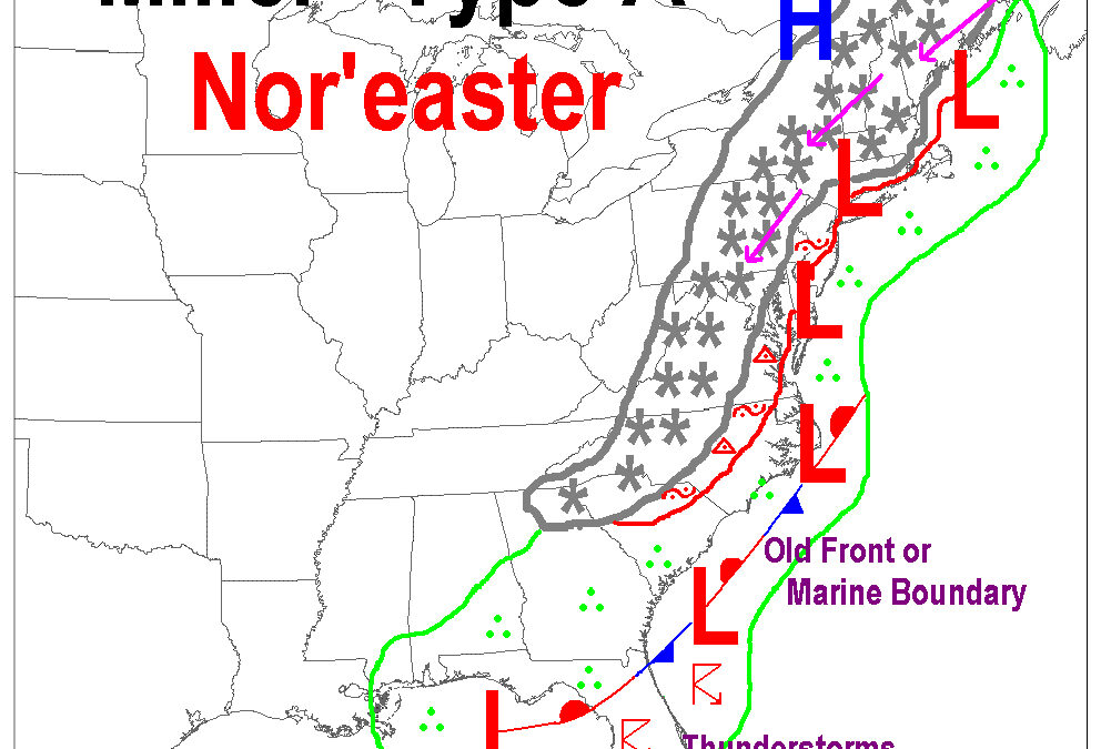
This is a type of nor’easter winter storm defined by the direction the winds usually blow from. The name comes from J.E. Miller, the researcher who came up with this naming system for East Coast storms in 1946.
They can happen any time of the year, bringing rain, wind and coastal flooding. However, it’s during the winter when they’re most frequent, and most apt to bring snow, sleet and freezing rain.
Whether it’s a Miller A or Miller B depends on where the low-pressure system originates.
In a Miller A storm, the low-pressure system develops in the Deep South, or the Gulf of Mexico. It strengthens as it moves up the East Coast. Then it will usually make a sharper turn to the northeast in the Mid-Atlantic or the Northeast. The Boxing Day blizzard of 2010 is an example of a Miller A storm when 10 to 20 inches of snow fell along the Jersey Shore.
Meanwhile, Miller B storms are a little more common. Miller B storms start as low-pressure systems moving east from the Great Plains and Midwest. The system then weakens as it hits the Appalachian Mountains. However, it transfers its energy offshore. Typically, this can happen between North Carolina and Long Island. It will then move to the northeast, strengthening as it does so.
Miller B storms are typically a little weaker than Miller A storms, since the ocean runway that intensifies storms is shorter than the Gulf of Mexico or Southeast forming Miller A systems.
However, they are still our best shot of plowable snows, with sleet, freezing rain and coastal flooding. In fact, the snow on Jan. 6 was a Miller B storm.

Alberta Clipper
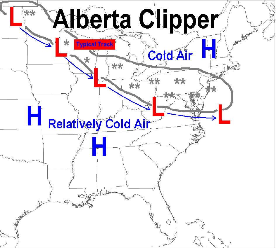
Alberta Clippers are low-pressure systems that are cold and fast-moving. They’re named after where they originate, in the Prairies of Alberta, Canada. After forming, they typically arrive in New Jersey in two or three days.
The low-pressure systems are fairly weak. Therefore, when we receive snow from these, it’s either light (under a half inch per hour) or moderate (a half inch to an inch per hour). Gusty winds come with this, too. However, they’ll be from the south, turning to the northwest with time. Alberta clippers happen numerous times a winter in New Jersey.
Snow Squalls
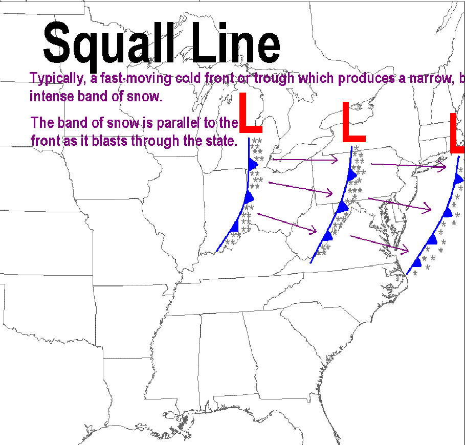
Think of snow squalls like a thunderstorm. They’re brief, but intense.
Snow squalls happen about once a winter or so here. Typically, they’ll form in Pennsylvania and quickly move east, dissipating as they do so. We see the weakened leftovers.
These can bring a quick inch or two of snow. Even if they don’t, they still will bring whiteout conditions. Also, like thunderstorms, strong gusts of wind are common. Power outages and wind damage aren’t ruled out.
Happens on occasion:
Norlun trough
A norlun trough is a highly focused area of snow on the northwest side of a low-pressure system. This is caused by an axis of shifting winds.
Snow from a norlun trough only lasts a few hours. It gives meteorologists headaches as the heavy band may only be 20 or 30 miles wide. A matter of miles makes the difference between snow you can easily brush off your car, or one where the snowplow will come around multiple times.
A great example of this happened on Dec. 5, 2018. Brigantine reported 7.5 inches of snow. Southern Ocean City picked up 2.5 inches of snow. Meanwhile, Toms River and Cape May had no measurable snow. That’s a narrow band of snow. My estimate is this happens two or three times per decade at the Jersey Shore.
Delaware Bay Effect Snow
My favorite kind of snow, which happens at part of the Jersey Shore, is Delaware Bay effect snow, the lesser-known sibling of the infamous lake effect snow from the Great Lakes. This only happens in lower Cape May County.
Similar to the more famous version of the phenomenon, this is caused by very cold air going over the relatively milder Delaware Bay. Specifically, it’s when the air temperature about 5,000 feet high is 23 degrees lower than the temperature of the bay surface, according to Penn State University. See link below:
https://www.e-education.psu.edu/meteo3/node/2270
Using the average bay temperatures during the winter, that means temperatures 5,000 feet high must be about 15 degrees or so. That happens a few times during the winter. However, winds need to be nearly due northwest to pick up the moisture off Delaware Bay. Since the bay is much smaller than the Great Lakes, there is little margin for error.
Plus, winds should be at least 15 mph. Add that all up, and Delaware Bay effect snow only happens a few times a decade. When it does happen, it’s typically flurries. However, an inch or two occurs on rare occasions.
Ocean Effect Snow
Ocean effect snow mirrors Delaware Bay effect snow, where cold air crosses warmer water. This happens when there is a northeast wind. There are two ways in which we’ll see flakes fly from this.
- Cold northeast winds from Arctic high-pressure over Quebec or Atlantic Canada. This rarely occurs at the Jersey Shore, but will happen once or twice a winter in Eastern New England.
- During the late stages of nor’easters, winds will be from the northeast. This leads to low-level snow under larger storm clouds. When it happens, this is most often in Ocean and Atlantic counties. This still doesn’t happen every winter, though.
It’s rare, but it happens:
Lake effect snow
Snow from the Great Lakes will reach New Jersey each winter. However, for this type of snow to fall in Atlantic and Cape May counties, everything has to be just right.
The Appalachian Mountains usually dry out the snow before it gets to the other side. Also, what is snow in the mountains might just turn to rain when it reaches here. The snow would need to come from Lake Erie, with the wind blowing directly from the west-northwest. The last time this happened was on Dec. 29, 2020, but it was just flurries. Snow that sticks around happens once a decade, if that.


