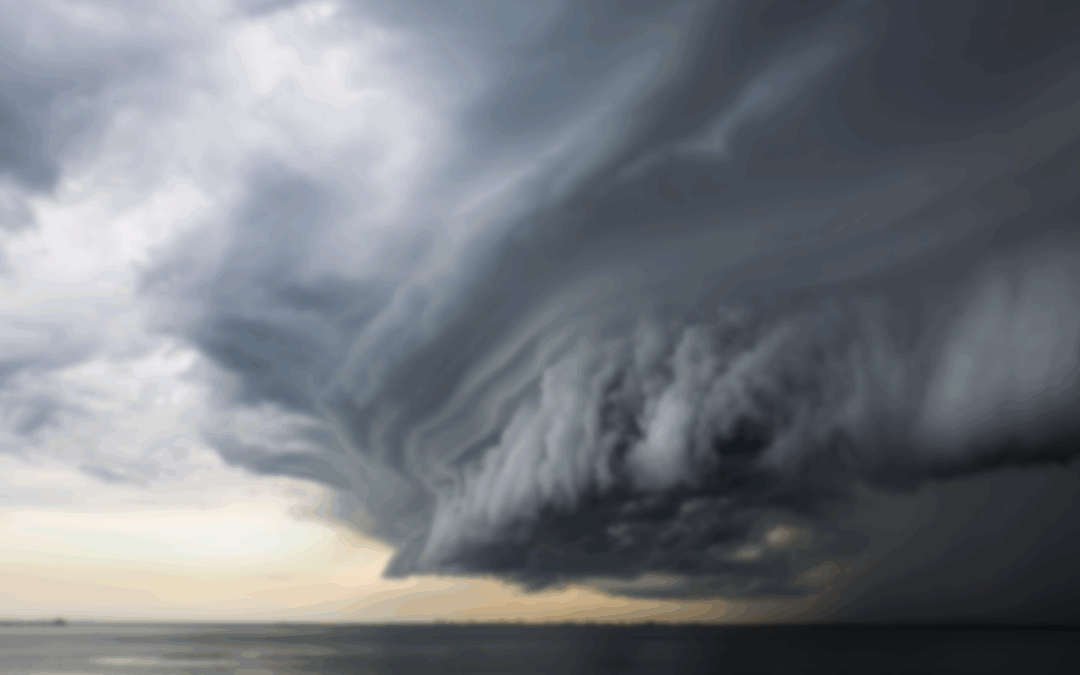
Name a state that sees plenty of severe thunderstorms and tornadoes. You’d probably say Oklahoma or Texas and you’d be right guessing any of those two. However in the second tier of states with the most severe weather, New Jersey is right there.
I looked at the number of severe thunderstorm watches, tornado watches and more from the Storm Prediction Center. The center is a government agency under the National Oceanic and Atmospheric Administration in Norman, Okla. They’re home to the smartest minds on tornadoes, hail, derechos and more.
Since records began in 1997, an average of 28 severe thunderstorm or tornado watches have been in or touched New Jersey, according to the Iowa Environmental Mesonet. A severe thunderstorm is issued when the Storm Prediction Center says the ingredients for damaging winds or hail are present. A tornado watch is issued to highlight the potential of tornadoes.
New Jersey gets about 2.9% of the 733 severe storm and tornado watches in the United States each year. That might not sound like a lot, but New Jersey contains only 0.2% of the country’s land, rivers and lakes, according to the United States Census Bureau. So, our state gets almost 15 times more bad weather than you’d expect for its size.
The Storm Prediction Center makes maps showing how many severe thunderstorm and tornado watches happen in each county every year. The latest maps cover 2004 to 2023.
Oklahoma is the top spot for bad weather, with some counties getting more than 20 watches a year. Other places like Kansas, Nebraska, Missouri, Texas, Arkansas and Mississippi also get a lot, with more than 15 watches a year.
In the Appalachian Mountains, the number of severe thunderstorm and tornado watches drops to about five a year. But on the eastern side of the mountains, it jumps to around 12 watches a year. That’s where the southern half of New Jersey is.
Cape May, Cumberland, Salem, Gloucester, Burlington and Mercer counties get about 12. Atlantic, Camden and Ocean counties get about 11. Monmouth gets about nine.
For more proof, we look at the number of severe weather risk days of at least a Level 3 of 5.
A Level 3 is known as an enhanced risk and is also issued by the Storm Prediction Center. That means numerous severe thunderstorms are “possible” (expected severe storms begin at Level 4).
Even here there’s a peak in New Jersey. Areas west of a line from Millville to Trenton to Hackettstown get two to five of these risky days each year. That’s one of the higher groups in the country. But along the Jersey Shore, there are fewer risky days.
Just like with storm and tornado watches, the Appalachian Mountains have much calmer weather. West of the mountains, in places like the Midwest and the Great Plains, the number of bad storms goes up again.
New Jersey gets worse weather than others, and that makes sense. From April to early August, we have a time when storms are more common. We often get strong winds that can knock out power. Sometimes, we get hail, but it’s generally small, not big like a penny or larger. The state also gets about two tornadoes each year.
Furthermore, many of us have stories to share of severe storms in the past. The June 2012 derecho brought significant wind damage to Atlantic, Cape May, Cumberland and southern Ocean counties. The next year, another derecho clipped the far southern tier of New Jersey. Winds of 60 mph and higher hit Cape May Court House,
Cape May and Cumberland counties. April 1, 2023 brought seven tornadoes and an Atlantic City waterspout to New Jersey. That tied the record for the most in a single day in New Jersey.
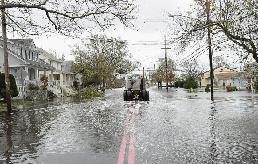
If you have a photo of the 2012 derecho, you can put it here. Otherwise, insert 2012 Derecho NJ Storm Reports and 2012.
New Jersey experiences severe weather because we regularly see a clash between warm, humid air from the Gulf and cool, dry air from the polar regions.
We might take that for granted here, but that doesn’t happen in California where the clashes are more between wet and dry air, without much of a temperature difference. It doesn’t happen much in South Florida either, where polar air from cold fronts rarely makes it down that far south.
The Appalachian Mountains have less bad weather for a couple of reasons. The tall mountains act like a wall, making storms from the west or southwest weaker. They also change the path of the jet stream, which is like a fast-moving river of air high in the sky that guides storms. If these mountains weren’t there, places like West Virginia and the western Carolinas would have as much severe weather as other areas.
In fact, cities like Baltimore and Washington, D.C., just to our west, rival the known severe weather hot beds like Dallas and Kansas City for the number of severe weather watches per year, around 15. We could see even more severe weather, but the relatively cooler Atlantic City, which lays right next to New Jersey, stabilizes the atmosphere a bit.
Hopefully, the rest of the summer will stay as severe weather free. It allows us more time for the boat, beach and boardwalk, plus working outside. Furthermore, less severe thunderstorms mean less risk for fatalities.
Joe Martucci, a Certified Broadcast Meteorologist and Digital Meteorologist, is the President and Director of Meteorology for Cup A Joe Weather and Drone. You can connect with him at cupajoe.live.