By Meteorologist Joe Martucci
Five to seven days before the New Jersey nor’easter that never was on Feb. 20, I received many messages about it. Here’s three examples (edited for clarity):
“How much snow are we getting Thursday? People in school are saying 15 inches.”
“Joe, are we really supposed to get over a foot of snow on Thursday? Apple Weather told me.”
“Someone said we are getting 15-18 inches of snow…”
What happened last Thursday? Snowy coatings south of the Cape May Canal with a gentle breeze out of the northeast.
These three messages, like the dozens of other other messages, comments and posts to me, all circled around the same concept: the generic weather phone app. Using it is fine 75% of the time, but just like calling a 1-800 number, when you really need an answer, you want a human to help you out.
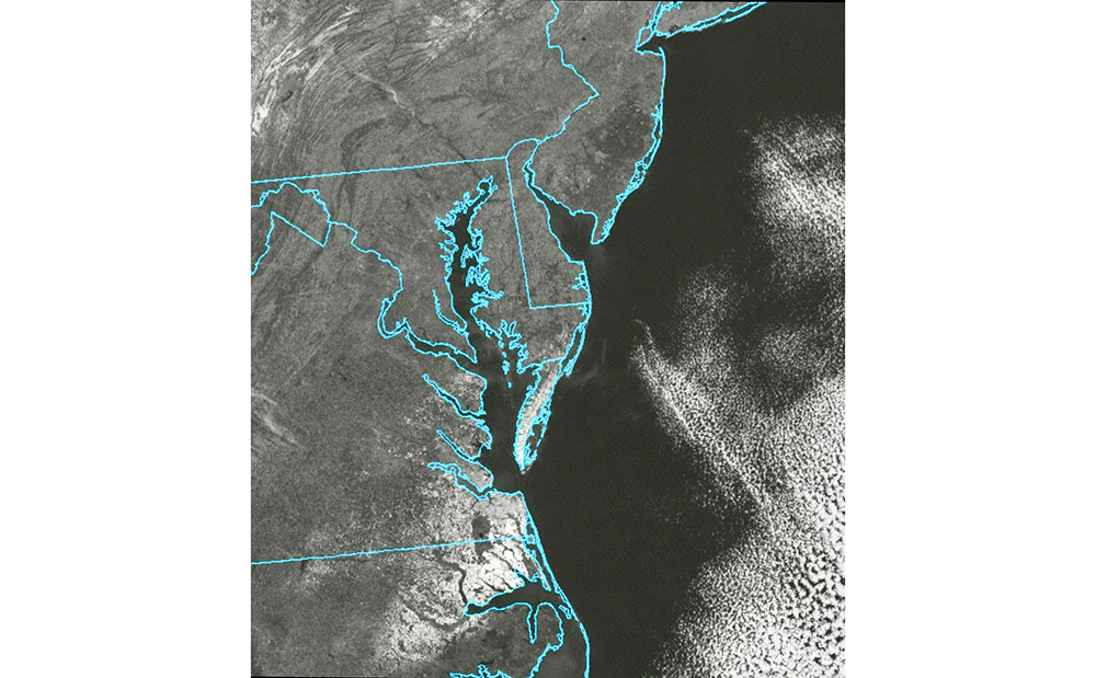
This doesn’t mean the nor’easter didn’t happen at all. Norfolk, Va. reported 11 inches of snow, Chincoteague Island, Va. off the Delmarva Peninsula reported 6.5 inches, and the Outer Banks of North Carolina reported 3 to 6 inches of snow according to the National Weather Service.
I, and every credible meteorologist I know of in the area, did not start putting out snow forecasts until Monday. That’s about 60 hours before any storm was supposed to come. My forecast, even on Monday, was for a lower impact event. No foot-plus forecasts or historic nor’easter for New Jersey.
Now this is not because we meteorologists hunkered down in a basement and decided to withhold the snow forecast from you. It’s because we know how nor’easters work and the limitations of computer modeling.
Think about this: Meteorologists have to be accurate because they work for the public or their bosses. Phone apps? Not so much. They’re made by companies to make money, not to help people. They just spit out computer guesses with no real risk. That’s why an app might say a foot of snow one day, then an inch the next, and then 6 inches after that.
Meteorologists, like the ones who work for the government or news outlets, are usually seen as people you can trust.
A long time ago, our job started because we wanted to keep people safe. When we say it’s going to snow, most folks believe us more than their phone apps. Our weather predictions help people get ready for big storms – like knowing when to leave their homes or stock up on supplies. Take Superstorm Sandy, for example. People listened to us to figure out what to do, not just some computer message.
Generic phone apps are quick, easy and give you an answer. That’s what we all want in life. I want that in life, too. But as they say, life is not always black or white. It’s just not that easy.
The reason I waited until Monday to issue a snow forecast was because of computer model limitations and an understanding of how the atmosphere works.
Weather predictions past 84 hours use global models that cover the whole Earth – about 12,430 miles from pole to pole. The distance from Ocean City, NJ, to Norfolk, Va., is just 1.5% of that, so it’s tiny compared to the model.
Therefore, on Feb. 13, 14, 15 and even 16, it was fair to say that a nor’easter would be around New Jersey on Feb. 20. However, it would have been impossible to pinpoint a snow forecast. Even if the generic weather app were right it would have been pure luck – like throwing a dart in the bullseye blindfolded.
Secondly, the nor’easter didn’t enter the United States’ West Coast until Sunday night to early Monday. That plays a role. When it enters the country, it can be sampled by the National Weather Service’s twice-daily weather balloon launches for weather data. That data then feeds into the weather computer models.
Third was that there was going to be plenty of dry air to the north. This was always going to bring a sharp cutoff in snowfall totals. It was why I thought our third “South Jersey Snow Special” was a good possibility on Monday, despite it not working out that way. But again, when the snow map first came out Monday, the highest snowfall forecast was 1.5 to 3 inches of snow for Atlantic and Cape May counties. Places like Medford and Trenton would see no accumulating snow.
The reality is that 75% of the time, using your generic phone app is fine. If it’s dry, it won’t really matter to us if it’s sunny, or partly sunny, or if it’s 65 degrees or 68 degrees. I get that.
However, when the specifics of the forecast really matter, that’s when a meteorologist comes in. When I used to work at the weather consulting company WeatherWorks in Hackettstown, we worked with movie production companies that needed accurate cloud cover forecasts. A phone app can’t do that. A meteorologist can.
The same goes for snow, hurricanes and coastal flooding. It’s going to take longer to get an answer from us than the phone app, but it has a better chance of being the right answer, and giving you the context you need. That’s why many of us still check in with meteorologists daily, even if the next week will be mild and clear.
Last week I had to call the Internal Revenue Service for something. After dialing the number, I pressed one automated prompt, then another automated prompt that I thought would help me out. It left me without the answer I needed and once the automated prompt ended, the call ended.
After a few tries of different combinations, I reached a very pleasant man in West Virginia. I explained my problem and he helped me out right away.
Human knowledge and context, aren’t going away soon.
Joe Martucci, a Certified Broadcast Meteorologist and Digital Meteorologist, is the President and Director of Meteorology for Cup A Joe Weather and Drone. You can connect with him at cupajoe.live.


