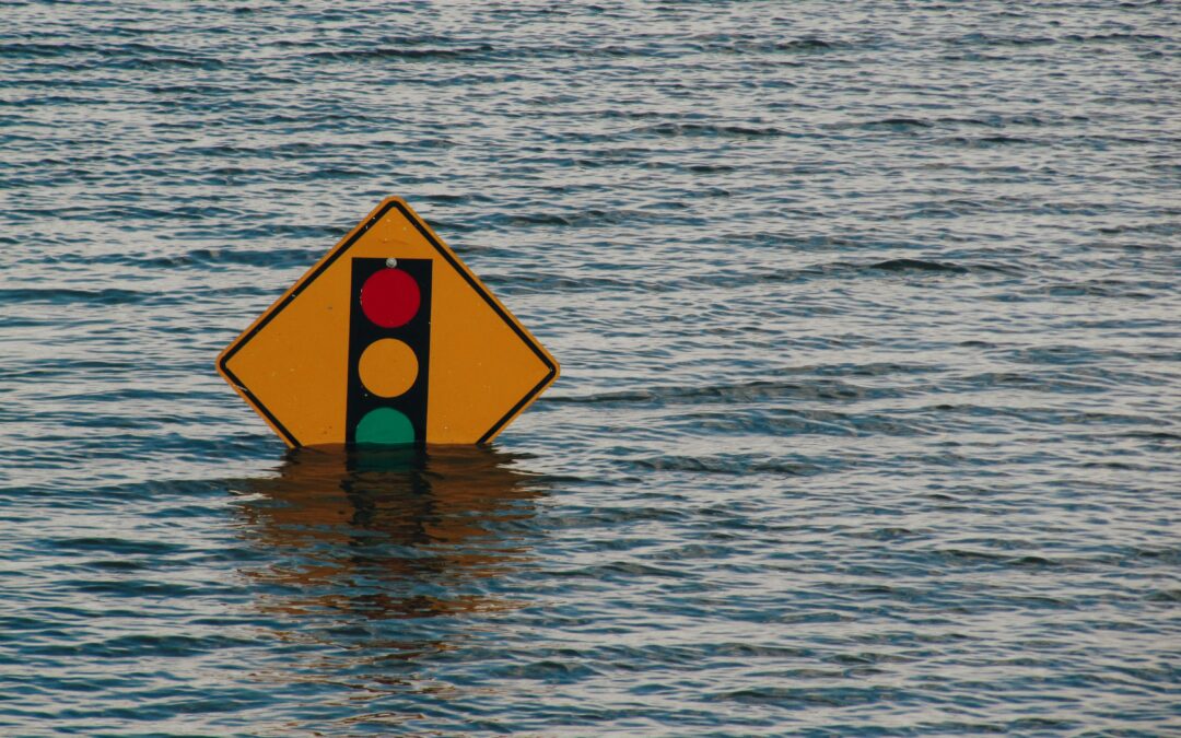
A new plan seeks to address an array of coastal and inland flood risks over the next 75 years by expanding the state’s flood maps. Critics say it would raise costs for New Jerseyans.
A controversial land management rules proposal meant to guard against floods in an expanding portion of New Jersey may see changes ahead of an August deadline for the Department of Environmental Protection to adopt or kill the package.
The scope of any possible changes to the Protection Against Climate Threats Resilient Environments and Landscape Rules — more succinctly, Pact Real — remains unclear.
Gov. Phil Murphy’s office confirmed the administration would hold public meetings about the rules proposal next week, but declined to confirm or detail potential changes to the 1,044-page plan.
The voluminous filing seeks to address an array of coastal and inland flood risks over the next 75 years by expanding the state’s flood maps, raising elevation requirements for new construction in areas affected by rising sea levels, and tightening drainage requirements, among numerous other things.
Environmental groups and some local officials have hailed the rules as a necessary step to protect residents and property in a state where severe storms are becoming more and more frequent.
“We’re not really asking for anything radical. We’re not asking for something completely outside of the box. This is just adapting to what we are already experiencing,” Anjuli Ramos, director of Sierra Club’s New Jersey chapter. “Just last week, there was a rain event, and multiple streets in Monmouth County and in Ocean County flooded.”
New Jersey saw 17 storms that caused at least $1 billion in damage between 2020 and 2024, according to data maintained by the National Centers for Environmental Information. There were 15 such storms over the preceding 40 years after adjustments for inflation.
Severe storms have assaulted other parts of the nation, and flooding from a Texas storm last week killed at least 109, including at least 28 children.
“The only thing that causes more damage than fire is water,” said Barbara Rogers, a township committeewoman in Cranbury, which saw severe flooding from Hurricane Henri in 2021.
Business groups, some Jersey Shore mayors, and the New Jersey Builders Association have opposed the proposed changes, arguing they would further raise New Jersey’s already high cost of living.
The heightened elevation requirement — which would mandate that newly constructed, reconstructed, or enlarged buildings be elevated to 5 feet above the high-water line — has been a frequent focal point of the proposal’s detractors.
“We don’t think it’s supported by the science, and it would be very costly and disruptive to people living at the shore and for businesses at the shore,” said Ray Cantor, deputy chief government affairs officer for the New Jersey Business and Industry Association, which opposes the proposal.
By adopting flood maps of its own that are more expansive than those maintained by federal environmental and emergency response agencies, the state risks mortgage lenders requiring more homebuyers to obtain flood insurance coverage, he said.
Proponents of the proposed rules have argued a larger subscriber pool could lower flood insurance rates — a claim Cantor doubts — as less precarious homes dilute the risk of frequent flooders.
The National Flood Insurance Program, which holds a majority of the country’s flood insurance policies, faces risk of a death spiral driven by claims to a tiny slice of its covered properties that repeatedly flood.
Cantor said a provision in the rules that would require deed notices to include a warning that a property “is likely to be subject to periodic inundation and associated flood damage” could impact property values.
“There are a thousand pages of bad proposals here. Cumulatively, it’s going to be a real negative drag on the state’s economy,” he said.