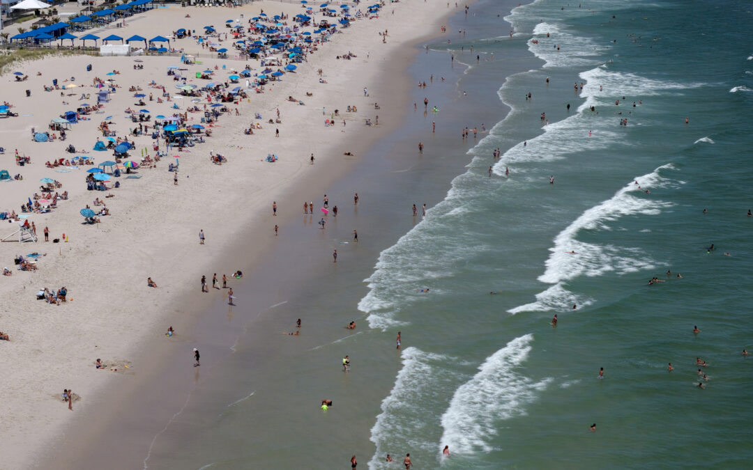
Despite some stormy and cool weekends this summer, there’s one thing we can say about the Jersey Shore right now: “Come on in; the water’s warm!”
The ocean water has been above average for most of the summer so far. According to the National Oceanic and Atmospheric Administration, 75-degree water temperatures were recorded off the Steel Pier in Atlantic City on July 5, 6, 8, 12-17, and 23-28. In other words, over half of the July days, the ocean water temperature was warm. That’s more like South Carolina than South Jersey.
It’s the complete opposite of last summer. June and July had zero days with a water temperature above 75 degrees. In fact, 11 July days were in the very chilly 50s, and 55 degrees was the 8 a.m. water temperature on July 18, 2024. Getting in the ocean was tough.
To explain why summer 2025 has been an absolute warm ocean lover’s delight, I’ll use another mantra: “Life’s at ease with an ocean breeze.”
Wind direction determines ocean water temperature
Ranking behind the strength of the warming sun and the currents, the direction of the wind plays the biggest role in water temperatures in New Jersey. In fact, it’s the main player for the day-to-day, or hour-to-hour variations.
Cooler ocean waters are caused by upwelling. Upwelling describes what happens when the typically warmer sea surface water moves away from the coast and out to sea. Colder water from the sea floor then rises to the top along the shoreline.
This is a critical part of our marine ecosystem. That cold water is nutrient-rich and keeps our living ocean alive.
Upwelling is caused by Ekman Spiraling, according to the American Meteorological Society’s glossary.
I’ll save the meteorology for you, but for the Jersey Shore, and the Northern Hemisphere, upwelling occurs any time the coastline is to the left of the direction of the wind. In our case it means a wind from the southwest or south. The Jersey Shore is to the left of the air current. That causes Ekman Spiraling, which pushes that warm water away.
On the other hand, warmer water gets pushed onshore with onshore winds. A wind from the southeast, east or even northeast will blow warmer-than-usual water in from the Gulf Stream our way.
From the time climatological summer began on June 1, to July 28, winds were out of the favorable southeast, east and northeast direction 30% of the time at Atlantic City International Airport in Egg Harbor Township, according to the Iowa Environmental Mesonet. Yes, the airport is inland, but the large-scale wind measurement known as synoptic wind direction, is usually the same between the airport and the coast itself.
During summer of 2024, winds blew from the southeast, east to northeast just 12% of the time. During the summer of 2025, it has been above the long-term average of roughly 20%.
Go up the coast and you have had the same results only more often. Readings at Monmouth County Executive Airport in Wall show wind direction out of the southeast, east or northeast a whopping 55% of the time through July 28, according to the Mesonet. Last summer it was about 30%.
Eighty-degree ocean water is possible come August
Offshore winds should continue to be a focal point of the August forecast, and with the climatological peak of our ocean waters coming at the end of the month, a few 80-degree ocean water temperatures are very possible.
While I’m not as keen on it as I was in our Halfway Through Summer Outlook column a few weeks ago, there is still a better-than-50% chance that the wind direction comes from the southeast, east or northeast more than average during August.
We average at least one day with a water temperature at or above 80 degrees at the Atlantic City station in August. So, hitting 80 is not unusual. However, given the constant 70s we’ve had up and down the coast so far, more onshore winds would likely give us at least a few days in the tropical 80s.
Shore summer weekend weather report card update
The report card’s been holding its own over the month of July. However, summer 2025 will need to study hard, put in the work and give us beautiful, dry weekends for August in order to keep this summer out of last place.
I graded the July 25-27 weekend a ‘B.’ That brings the grade point average since Memorial Day Weekend to a 2.7 – right around a B-minus.
In the eight summers that I’ve graded the weekend weather, the lowest final grade point average was a 3.0 back in 2021.
Climatologically, our weather becomes less rainy in mid-August. So, there’s still time to earn a few ‘A’ grades and dig out of last place.
Joe Martucci, a Certified Broadcast Meteorologist and Digital Meteorologist, is the President and Director of Meteorology for Cup A Joe Weather and Drone. You can connect with him at cupajoe.live.