Weather
By Dan Skeldon
And we’re off.
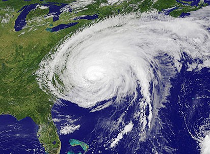
Welcome to June, and with it, the official start of the Atlantic hurricane season.
Although more often than not, at least over the last decade, the season has started early, with May tropical systems in the Gulf of Mexico or off the southeastern coast of the United States.
And some, like yours truly, would say that there was some sort of tropical system that battered the Carolinas over the recent Memorial Day holiday weekend. It wasn’t officially named, and it thankfully spared South Jersey everything but some cloudier intervals and an occasionally brisk onshore breeze. But could the early East Coast activity be a harbinger of what’s to come?
‘Tis the season, from June 1 through November 30, every year in the Atlantic, with the traditional peak occurring from late August through early October.
First, let’s start with the 2023 list of names for any tropical storms and hurricanes that form in the Atlantic Ocean, including the Caribbean Sea and Gulf of Mexico. Remember, there are 21 names used on our list, which is repeated every seventh year. All letters are represented, except Q, U, X, Y, and Z, and names alternate between boy and girl right on down the list. Names of English, Spanish, and French origins are selected, as those are the primary languages spoken around the Atlantic basin in areas most often impacted by tropical systems.
The 2023 names are: Arlene, Bret, Cindy, Don, Emily, Franklin, Gert, Harold, Idalia, Jose, Katia, Lee, Margot, Nigel, Ophelia, Philippe, Rina, Sean, Tammy, Vince, and Whitney.
These names were last used in 2017, and before that, in 2011 and 2005. Remember Irene struck South Jersey in 2011, and that name was retired and replaced with Irma. Then in 2017, Irma devastated parts of the Caribbean and Florida, and was likewise retired and replaced with Idalia. The letter “I” is the most popular first letter of retired tropical systems, with 13 “I” storms retired over the years. Other new names on the list this year are Harold (replaces Harvey), Margot (replaces Maria), and Nigel (replaces Nate). Those three storms were all retired in the very busy 2017 season, with Harvey causing massive destruction in Texas and Maria the worst storm to ever strike Puerto Rico. Nate was a powerful hurricane that struck parts of Central America.
Now names aside, the next step is forecasting just how active or tranquil of a season lies ahead. And that always begins with the disclaimer that long range forecasting is a challenge, certainly much more so than the typical seven day forecast. That being said, forecasting the number of storms that we will see in an upcoming season has had an increasingly high skill over the last few decades. And whether the forecast is right or wrong in the end, these preseason forecasts serve an important purpose. Quite simply, it raises the awareness ahead of the coming season, and hopefully gets people thinking and better yet preparing for whatever the summer and fall hold in store, tropically speaking.
Let’s also remind you what an “average” Atlantic hurricane season is these days. Our average numbers have ticked up over the last few decades, with active seasons occurring more often than not. While a truly “average” season seldom occurs, we expect around 14 named storms in an average year in the Atlantic, with about half of them (7) strengthening and becoming hurricanes, and about 3 major hurricanes, achieving Category 3 intensity or greater. No matter how many storms there are, it’s always important to remember that it only takes one landfalling hurricane to define a season.
Now, what may be the two biggest factors in determining this year’s activity is a developing El Nino, the first in years, as well as warmer than average ocean temperatures across much of the Atlantic basin.
Let’s start with the latter, the warmer ocean waters in tropical breeding grounds, including off the Southeast Coast and near the Gulf Stream. Warmer than average ocean water obviously favors more and/or stronger storms, presuming storms can first organize. So this would be one sign for more activity this year, and perhaps more close in development along and off the East Coast from Florida to the Carolinas.
However, a just developing El Nino will likely be the bigger determinant. El Nino, and its counterpart La Nina, are a recurring climate pattern that follow a roughly 7-year cycle in the Pacific Ocean. It impacts water temperatures off of South America, as well as pressures and winds through the central Pacific Ocean. And while thousands of miles away from the breeding grounds of Atlantic hurricanes, the ENSO cycle (as it is known) can have a huge impact on our hurricane season.
We’ve had three consecutive years with a La Nina, which favors above average tropical activity in the Atlantic. Conversely, an El Nino usually (but not always) leads to below average activity. The main reason: it increases winds that blow the tops off thunderstorms of developing tropical systems in the deep tropics, in turn weakening them and hindering development. But just how quickly this El Nino develops is the wild card this year. If it only slowly takes hold, our hurricane season can still be quite active. A more rapidly strengthening El Nino would likely limit development.
So the official NOAA forecast calls for a 40% chance of an average season in terms of the number of storms, and says 12-17 storms is the most likely outcome at this point. That seems reasonable given the above factors, with a 30% chance of both a below and above average season, with the strength of the El Nino again the main wild card.
As always, only time will tell. But now is the time to prepare and ensure your hurricane readiness, in case a storm turns up the East Coast later this year.
Meteorologist Dan Skeldon has a degree in meteorology from Cornell University. He has forecasted the weather in South Jersey for the last 18 years, first on the former television station NBC40 and then on Longport Media radio. Dan has earned the American Meteorological Society Seal of Approval for Broadcast Meteorologists, and now does television broadcasts on WFMZ-TV in Pennsylvania’s Lehigh Valley.


