Weather
By Dan Skeldon
Welcome to December, and the start of “meteorological” winter, which we meteorologists define to be the months of December, January, and February. Note that if you go by the calendar, then “astronomical” winter hasn’t quite arrived yet, and it’s still fall for a few more weeks, until 4:47 pm on Wednesday, December 21st.
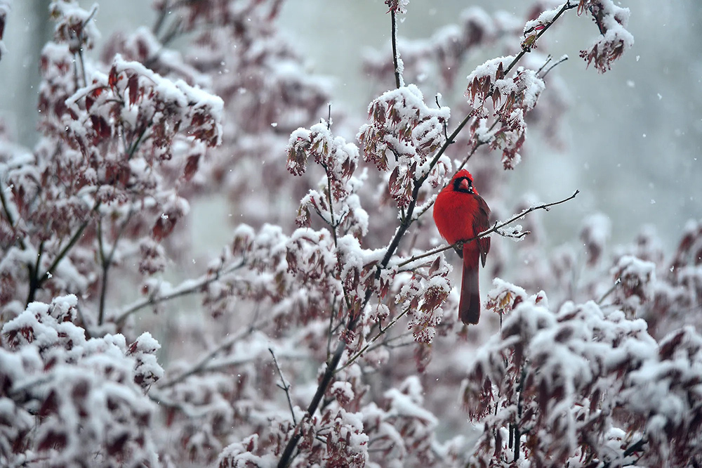
So depending which definition you accept, winter has either begun, or its arrival is imminent. And with that comes the talk of snow, which is either a four letter word that makes you cringe if you’re not a fan of the dreaded “white stuff” or makes you giddy at the mere mention of the chance of a few flakes. Of course, I’m in the latter group, and a lifelong snow lover ever since the “Blizzard of 1978” buried my northern Rhode Island town in 55 inches of snow. Granted, I was two years old and have no actual memories of the storm, but the pictures were spark enough.
Now if you’ve followed my forecasts over the years, you know all too well that I don’t put much stock in long range forecasts for the entire winter. However, I do believe there is increasing success in weekly and sometimes even monthly outlooks. That’s especially true during certain weather patterns, which can be easier to predict than others.
As luck would have it, we appear to be having one of those more easily predictable patterns setting up for December, most notably by the middle and perhaps through the end of the month. And if past history is any sign, then lovers of cold and/or snow have something to be excited about, but not until after a relatively mild first 7 to 10 days of December overall.
So what is the reason for snow lovers in the Northeast and Mid-Atlantic to be optimistic this December? The main reason has to do with something meteorologists call “blocking” up over Greenland and the far reaches of the North Atlantic. Think of a “block” as a meteorological traffic jam of sorts. A strong and sprawling area of high pressure sets up somewhere near Greenland, and disrupts the jet stream, which is the fast river of air that steers our storms and acts as a thermostat, separating cold air to the north from warm air to the south. With that traffic jam in place, the jet stream buckles and bends, cold air builds up in Canada and often gets sent south into the United States. In addition, the buckling of the jet stream can sometimes lead to notable storms along the East Coast, which feed off the clash of cold Canadian air and the warmer air over the Atlantic Ocean.
Sure enough, there is pretty strong agreement among our various computer models that strong blocking in the North Atlantic is going to develop over the first half of December, and may be a recurring feature through the first half of winter overall. If that blocking develops as forecast, it certainly ups the ante for colder than average temperatures for the middle and quite possibly the end of December, despite a fairly tranquil start to the month temperature-wise. Cold is of course one of the two ingredients you need for some early season snow. The other is a storm or two, which isn’t necessarily a given even when there is strong blocking. But odds of a storm still increase nevertheless.
Curiously enough, guess which years had as strong of a blocking signature in December that this upcoming December is forecast to have? The answer: December 2009 and December 2010. If those two months ring a bell, that’s no surprise, as South Jersey saw over a foot of snow on December 19, 2009 and then up to two feet of snow during the Boxing Day Blizzard on December 26, 2010.
Let’s be clear. I am NOT saying that we’re in for a repeat of either of those Decembers. But the pattern is similar, and at the very least, should bring several shots of early season cold our way by mid-month. That cold first comes down through the western and central United States over the first 7 to 10 days of the month, then likely shifts its way in our direction thereafter. Whether we are cold and dry with only some light snow opportunities or cold and stormy with a bigger storm potential still remains to be seen. But the “predicted” upcoming pattern for this December certainly suggests that some (but not necessarily all) Northeast snow lovers have something to be optimistic about in the weeks before Christmas. Let’s remember though that the pattern is a predicted one, and that prediction has to first come true before cold and snow chances take off. So as always, time will tell.
I will say that given the predictions though, our chances for a white Christmas this year may be at least a “little” higher than our historical chances, which sit between 5-8% for seeing at least one inch of snow on the ground on Christmas morning. As a starting point, I’ll double that, and say our chances are around 15% this year. That’s twice as good as normal, but that’s still an 85% chance of not seeing one. However, every white Christmas forecast has to start somewhere, so let’s see what evolves this month and how those chances can change going forward. If you’re a South Jersey snow lover, that means cheering on the big Greenland Block!
Meteorologist Dan Skeldon has a degree in meteorology from Cornell University. He has forecasted the weather in South Jersey for the last 18 years, first on the former television station NBC40 and then on Longport Media radio. Dan has earned the American Meteorological Society Seal of Approval for Broadcast Meteorologists, and now does television broadcasts on WFMZ-TV in Pennsylvania’s Lehigh Valley.


